


Chesapeake Bay shorelines are gradually disappearing as sea level rises and higher high tides eat away at beaches and fragile, sandy cliffs. And while that causes anxiety for some waterfront property-owners, it also creates a dilemma for archeologists and paleontologists.
They’re gradually losing important sites and artifacts to the water.
Craig Rose, part of a team of archaeologists from Longwood University in western Virginia, slogged along the shores of the Little Wicomico River one recent morning, complaining that "most of the shorelines we’ve encountered are either covered in rip rap or basically inaccessible."
The team wasn’t having much luck trying to map artifacts along the river on Virginia’s Northern Neck, he said. They only found "one or two sites" they could look at that day.
And it’s not just archaeologists having a hard time with rising tide, increasing erosion and efforts to stop it.
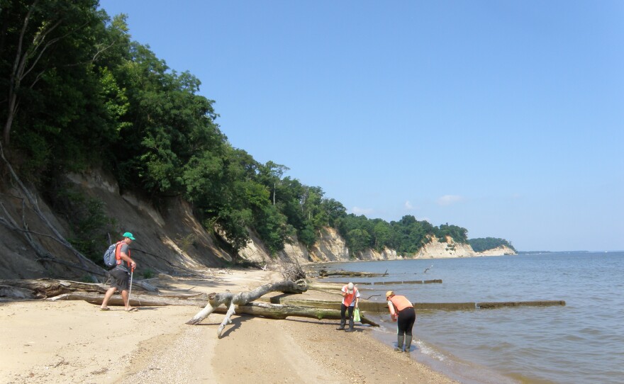
John Nance, a paleontologist from the Calvert Marine Museum, says rip rap, the large rocks used to protect shorelines, makes it more difficult for him to find fossils.
"People put piers in, erosion control, rip rap is the big one, all of that changes the dynamics of the beach," he said while leading a group of interns on a search along the banks of the Potomac just downstream from Virginia's Stratford Hall Cliffs.
"Along a number of the sections where we used to be able to collect where they've rip rapped, there's virtually no beach there unless it's a very low tide," he said. "It's one of the things we run into more and more frequently now."
Today rip rap, bulk-heading and other hard scaping are temporary fixes that will eventually give way to rising waters.
In Maryland, coastal waters are estimated to rise by about two feet by 2050 and by nearly four feet or more by this century’s end. Annapolis and Baltimore are among the top ten places in the U.S. that will experience an increase in what's called nuisance flooding, where roads are closed and storm drains overflow.
Sites mapped by Longwood archeologists will be compared to aerial photographs from the 1930s to help the Virginia Department of Historic Resources and National Park Service determine archeological sites most threatened by rising sea-levels.
They want some idea of how much longer those sites are going to be around, Rose says.
"Some might be gone in five years and some might be gone in 200 years. So they're able to prioritize any future funding that they get to focus on the most threatened archeological sites."
The team plans to use data collected from researchers around the bay who are doing similar work.

